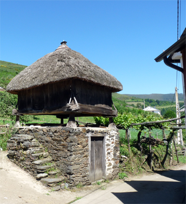
Chao d'Arqueira
San Antolín – Cecos - Pena de Tuña - Chao da Serra - Penas de Cuantas – Chao d'Arqueira - Caldevilla - San Antolín.
The route starts in front of the San Antolín town hall, bordering the church and going down to the river Ibias. Before crossing it, turn right and follow a group of concrete paths that go over the low part of the village and finished on the AS-211 road, that you have to take to continue to Mergulleira.
In Mergulleira there is a crossing up to Lagüeiro and Cecos (that goes next to the Ron palace façade). From here and going back by paths, the route foes to Cadagayoso. After this village, go down to the AS-212, that goes up a bit, and leave ir by a pavement road to Rellán. Before arriving to the village, take a soil path, to the left, to go to the sierra.
You will reach quickly tops, that allow you to enjoy good panoramic views over the valley. You can see the villages’ distribution, their fields and the Atlantic (chestnuts, oaks ...) and pine woods.
After reaching the Peña de Tuña area, border it, leaving it to the left (if you border it all, you will reach the same point but going a bit into Galicia and doing a pair of kilometres more). You have to ignore the fire-lane and crossings of other roads and go to the Chao da Serra, bordering pastures and crossing pine woods to teach, near Linares, the fire extinction base. You only have to cross the road to Santiso and Buso in the Chao d’Arqueira, and follow a soil path that will descent soon to reach the village of Caldevilla and continue down to San Antolín again.
TRACK INFORMATION
Distance: 28,62 km
Difficulty: media-high
Ascent gradient: 915 m.
Descent gradien: 915 m.
Type: circular
Crossing: all year