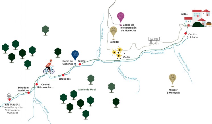
Mual - Las Tablizas
A walk that starts going over the village of Moal, where you can enjoy the views over fields, traditional constructions and typical cattle of the area.
After passing the village, the path goes by the river Miniel.los near the entry to the Muniellos nature reserve, where there is an ancient hydroelectric power station.
The last metres will bring you to the house of the guard, where the Visitors Reception centre of Muniellos is located. It has a parking.
TRACK INFORMATION
Origin: Mual
Duration: 1 h.
Distance: 5,46 km
Type: track
Crossing: all year

DO YOU KNOW THAT…?
Along the walk, you will see one of the most special constructions of the region, the ‘cortín’. This is a circular construction, made of stone. It has walls of 2m high and has no roof. It is used to protect the hives from fire and sweat-toothed bears.
DON’T MISS...
The visit to the house of the guard, nowadays Visitors Reception centre of Muniellos. There you will be inform of this special natural place, visited only by 20 people per day, and which forests are habituated by bears, capercaillies and roe deers, among others.